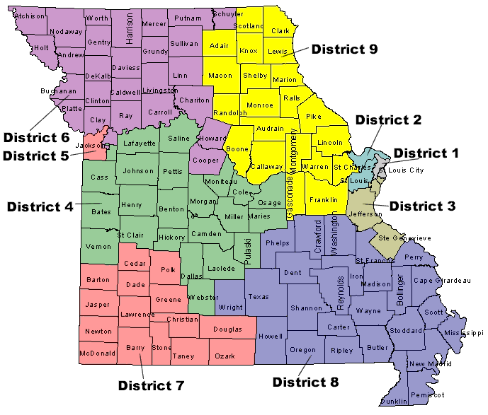
Distribution of Slaves in 1860

In 1861, in an attempt to raise money for sick and wounded soldiers, the Census Office produced and sold a map that showed the population distribution of slaves in the southern United States. Based on data from the 1860 census, this map was the Census Office's first attempt to map population density. It is a precursor to population density maps that have been produced since the 1870 census and especially forshadowed the work published in the Statistical Atlas of the United States by Francis Walker in 1874.
Download or Print This Map


Related Information

Page Last Revised - February 12, 2025